For clients who need ultra-fine resolution and digital-twin capability, AeroDynamic Drone Services now offers a specialized 3D modeling service tailored to infrastructure, buildings, towers, antennas and other important assets.
What You Get
A high-resolution 3D model of the target structure or asset, captured with overlapping oblique and nadir imagery, optimized for fine feature fidelity.
Deliverables include:
Processed 3D model files (commonly point cloud, mesh and textured model format for client review)
Option to supply RAW imagery for client processing (if preferred)
Optional orthomosaic/top-down extract specifically of the modelled asset, for plan-view use
Mission captured on the DJI Matrice 4E platform, featuring:
4/3″ 20 MP wide-angle sensor with mechanical shutter (reduces motion blur)
Smart 3D Capture mode with five-directional oblique imaging, enabling complex shaped assets and improved model accuracy
RTK/PPK positioning capability (horizontal: ~1 cm + 1 ppm; vertical: ~1.5 cm + 1 ppm) via the Matrice 4E platform
Accuracy & Resolution
Target ground sample distance (GSD): ≈ 0.20 cm – 0.50 cm/pixel, depending on asset size, flight parameters, and detail required.
Typical area scope: structures, towers, antennas, façades or small buildings (rather than wide-area mapping).
Because of the combination of oblique capture, mechanical shutter, dense overlap and the Matrice 4E’s high-spec sensor, you’ll obtain models with significantly more fidelity compared to standard orthomosaic-only flights.
Why This Matters
Higher resolution (sub-centimeter GSD) means you can clearly resolve fine features: fasteners, structural joints, antenna elements, façade textures, towers, ladder rungs, etc.
Oblique multi-angle imagery ensures the 3D model isn’t just flat — it captures depth, overhangs, complex geometry and volumetric assets.
The Matrice 4E’s mechanical shutter and five-direction capture improve data quality and reduce errors in the model reconstruction.
Deliverables support professional workflows: digital twin creation, inspection planning, structural asset documentation, BIM integration, and more.
Ideal Use-Cases
Small-footprint structures: e.g., a maintenance building, communications tower, antenna array, bridge footing, small industrial building.
Façade and rooftop asset modeling for roof-top equipment, solar panels, HVAC units, antennas.
Structural documentation for renovation, inspection, asset management, or digital twin creation.
Highly detailed capture for marketing visuals, heritage asset preservation, or client deliverables requiring highest fidelity.
Important Notes / Constraints
Because of the ultra-high resolution and dense capture pattern, flight time and processing time are greater than standard mapping missions — this will typically result in higher cost relative to our standard orthomosaic service.
Asset size must be manageable — large campuses or wide-area zones are better suited for our standard mapping service rather than ultra-detail mode.
Site access, lighting, obstructions, surface texture and ground control affect final output quality — we’ll always review these in the quote stage.
Deliverables may number many gigabytes (RAW imagery + point clouds + meshes) — we’ll coordinate delivery format with you.
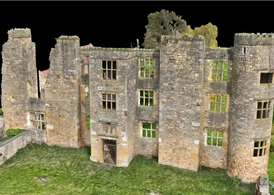 Image 1 of 7
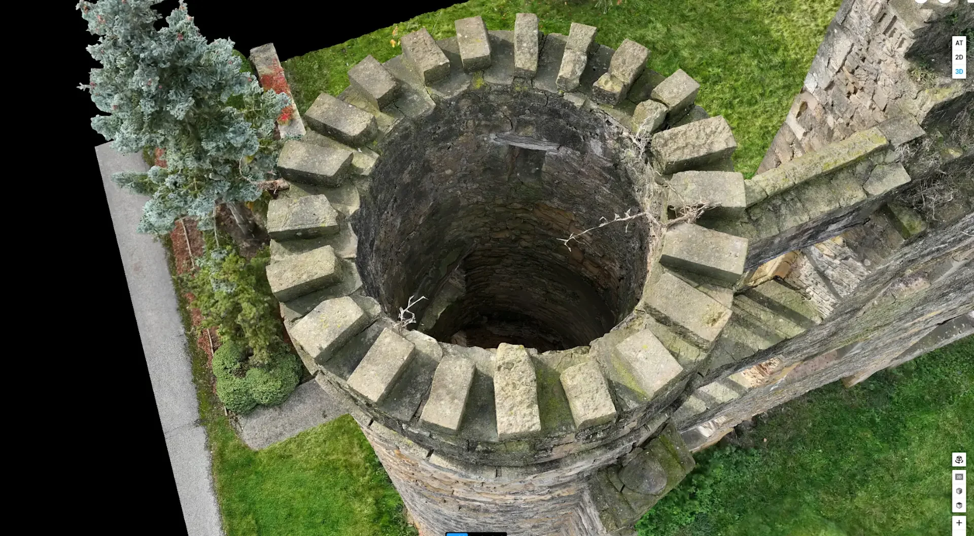 Image 2 of 7
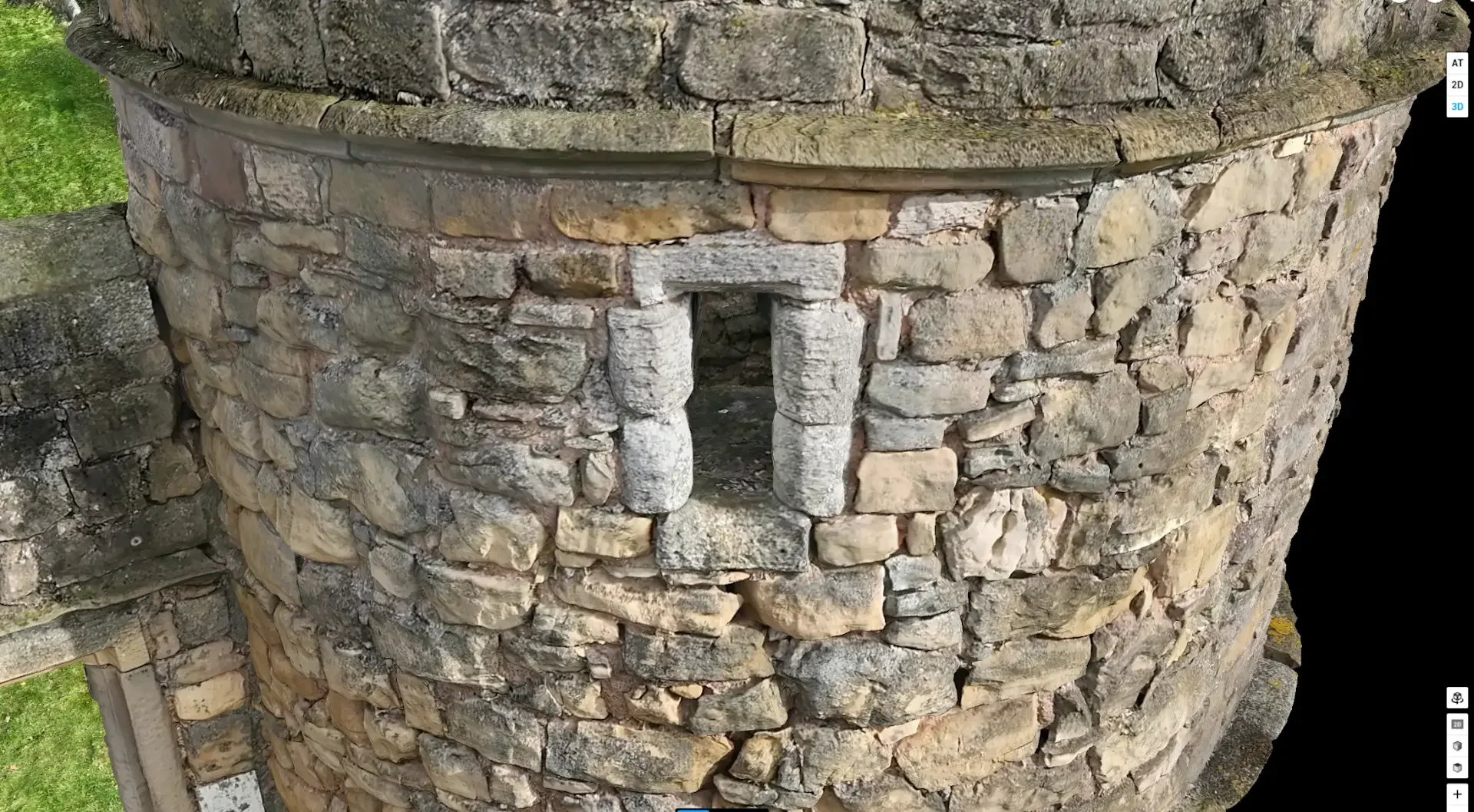 Image 3 of 7
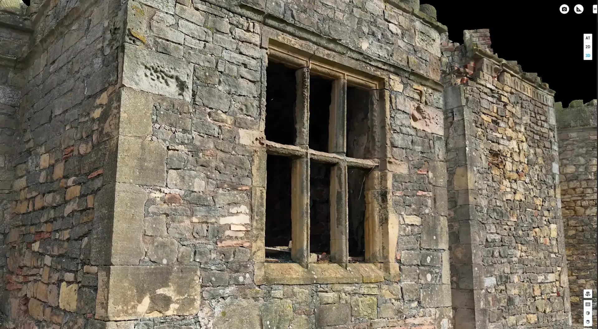 Image 4 of 7
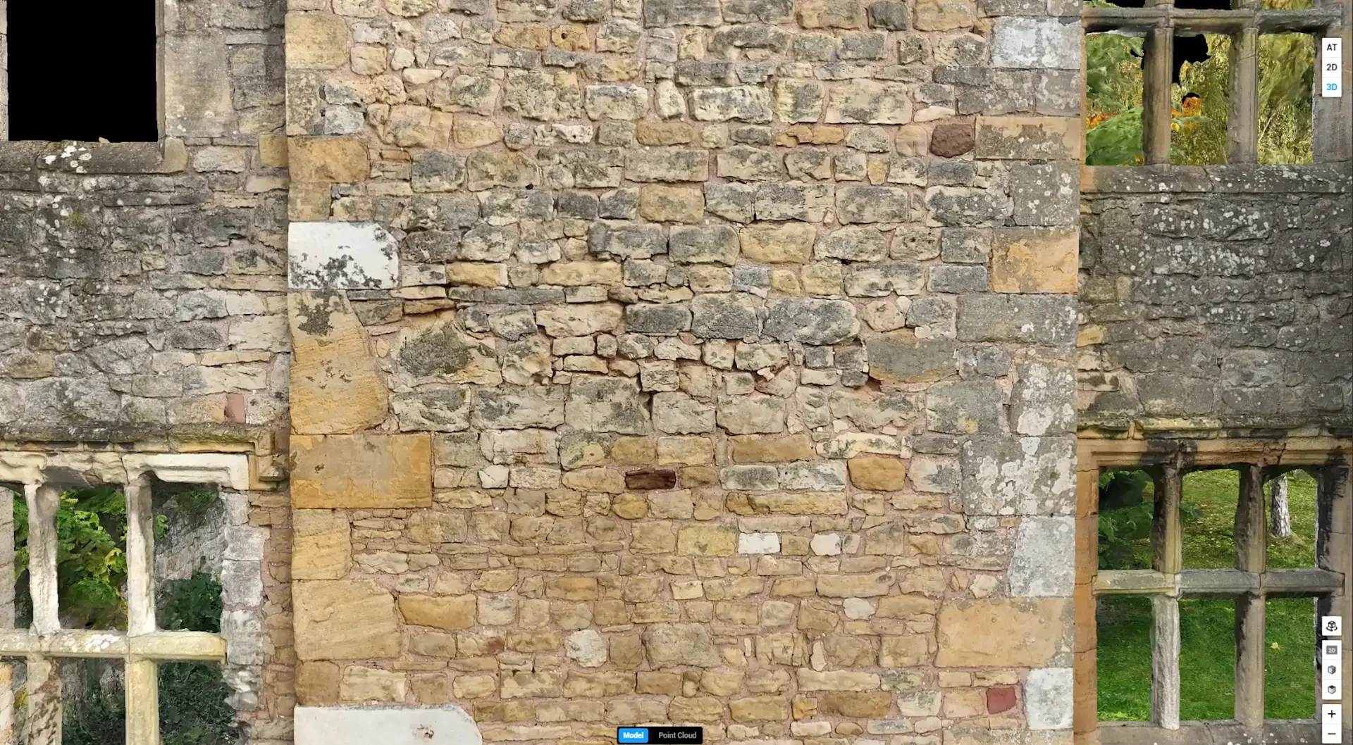 Image 5 of 7
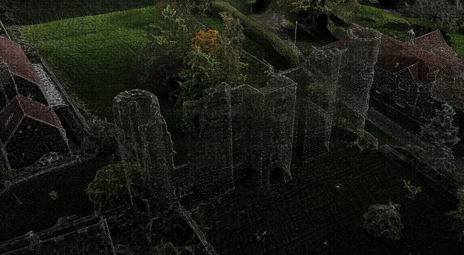 Image 6 of 7
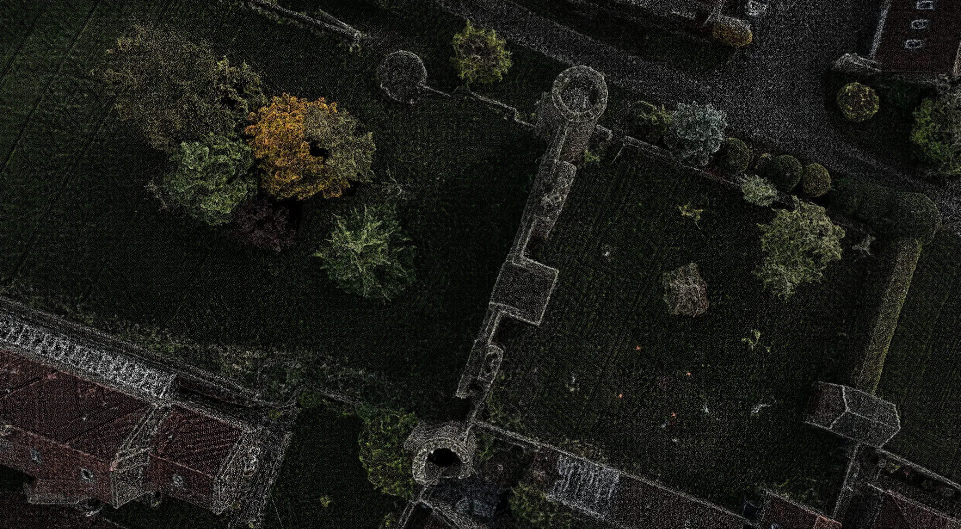 Image 7 of 7