Aerial Mapping & Drone Services in Vermont
Our Aerial Capabilities:
Orthomosaic Mapping & Survey-style Imaging (centimeter-level precision)
Construction Progress & Site Documentation
Real-Estate Photography & 4K Video
3D Modeling / Digital Twins (photogrammetry, RTK workflows)
Visual Inspections
AeroDynamic Drone Services delivers professional drone mapping, aerial photography, videography, and 3D modeling across Vermont. We help real estate, construction, and environmental teams capture high-resolution aerial imagery and accurate, measurable data—faster, safer, and more cost-effective than traditional methods.
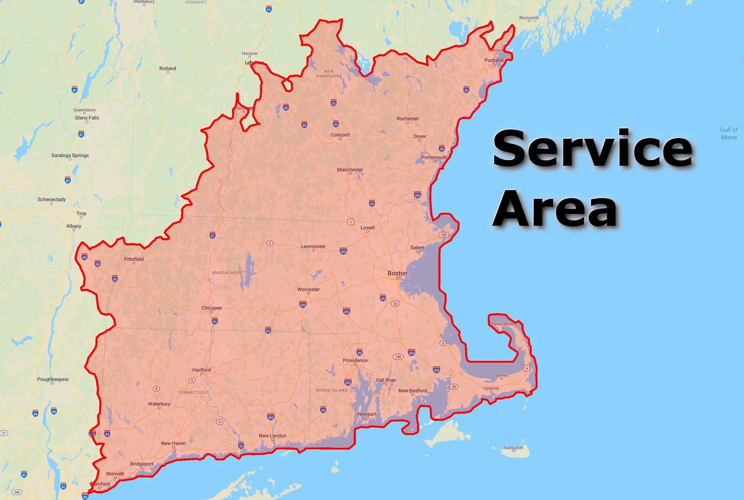
Areas We Serve in Vermont:
Our aerial photography and mapping services extend throughout Vermont, including Burlington, Montpelier, Rutland, Stowe, and Brattleboro. We support real-estate, construction, and environmental projects with precise imagery and mapping that showcase the Green Mountain State from a whole new angle.
Request a Quote
Tell us about your site and timeline—we’ll suggest the right capture plan and deliverables. Get a Vermont Quote
What You’ll Receive:
High-resolution deliverables ready for GIS/CAD/BIM or marketing
Clear licensing and usage rights for your team and vendors
Fast turnaround and reliable communication