
AeroDynamic
Drone Services
Elevate Your View - Smarter. Faster. Safer.
Professional Drone Services in New England
Drone Services Built for Real-World Decisions
From solar roof mapping with CAD Deliverables for Installers and 3D modeling for project managers to thermal inspections for electrical systems/solar panels and aerial media for marketing, we deliver accurate, ready-to-use data tailored to your site and how you plan to use it.
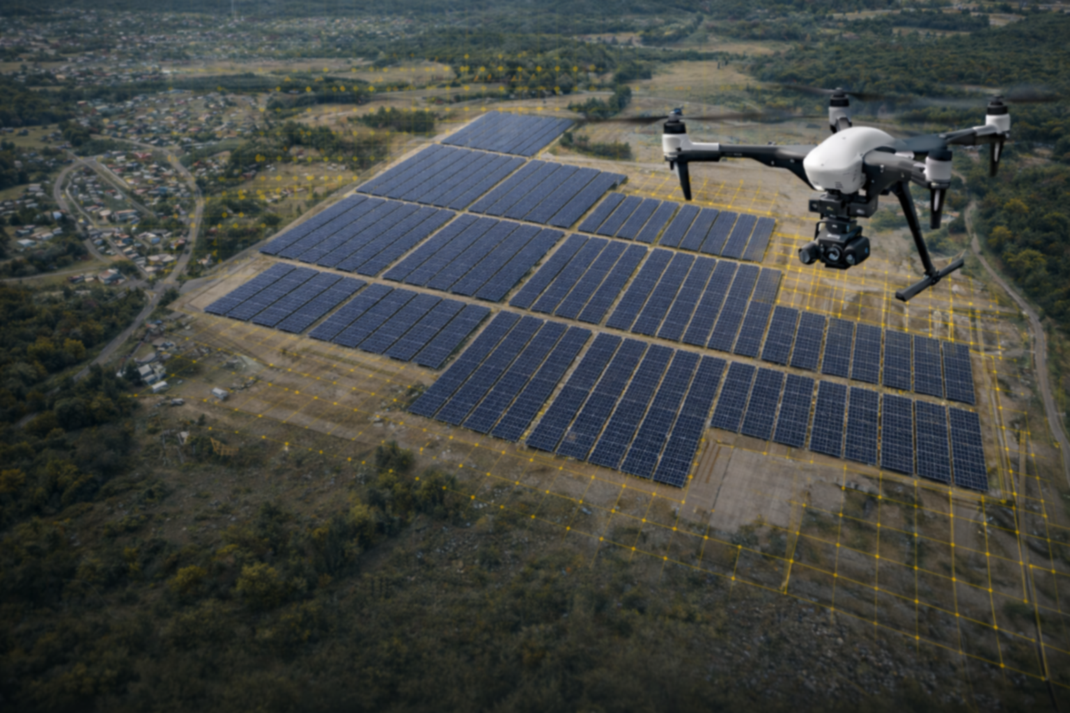
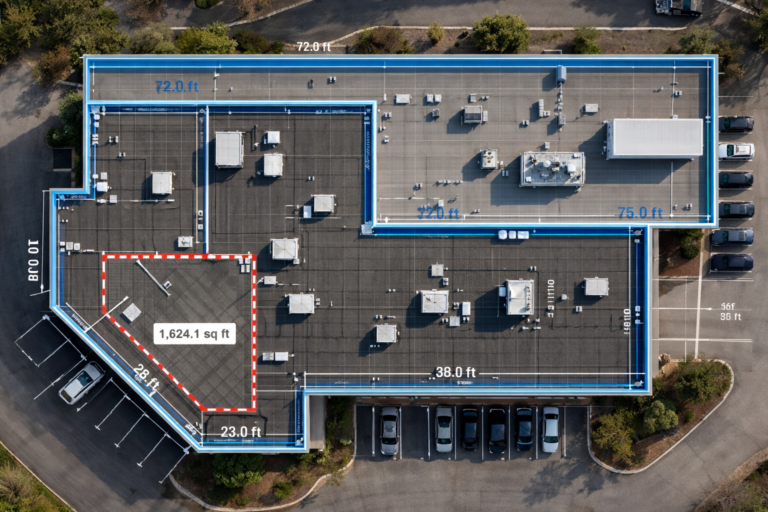
Solar Roof Mapping & CAD Deliverables for Installers
-
We capture accurate, distortion-free maps you can use for site planning, infrastructure inspection, progress tracking, and reporting. This is a good fit when you need measurable, repeatable data, not just visuals.
Best for:
Site development • Construction planning • Asset inspection • Progress documentation -
We provide roof ouline polyline schematics using orthomosaic maps of buildings for planning and engineering of solar panel planning.
Deliverables include:
GeoTIFF orthomosaic
DXF roof outline + obstruction polylines
Standard layer naming
Best for:
• Solar installation planning • Asset inspection • Progress documentation -
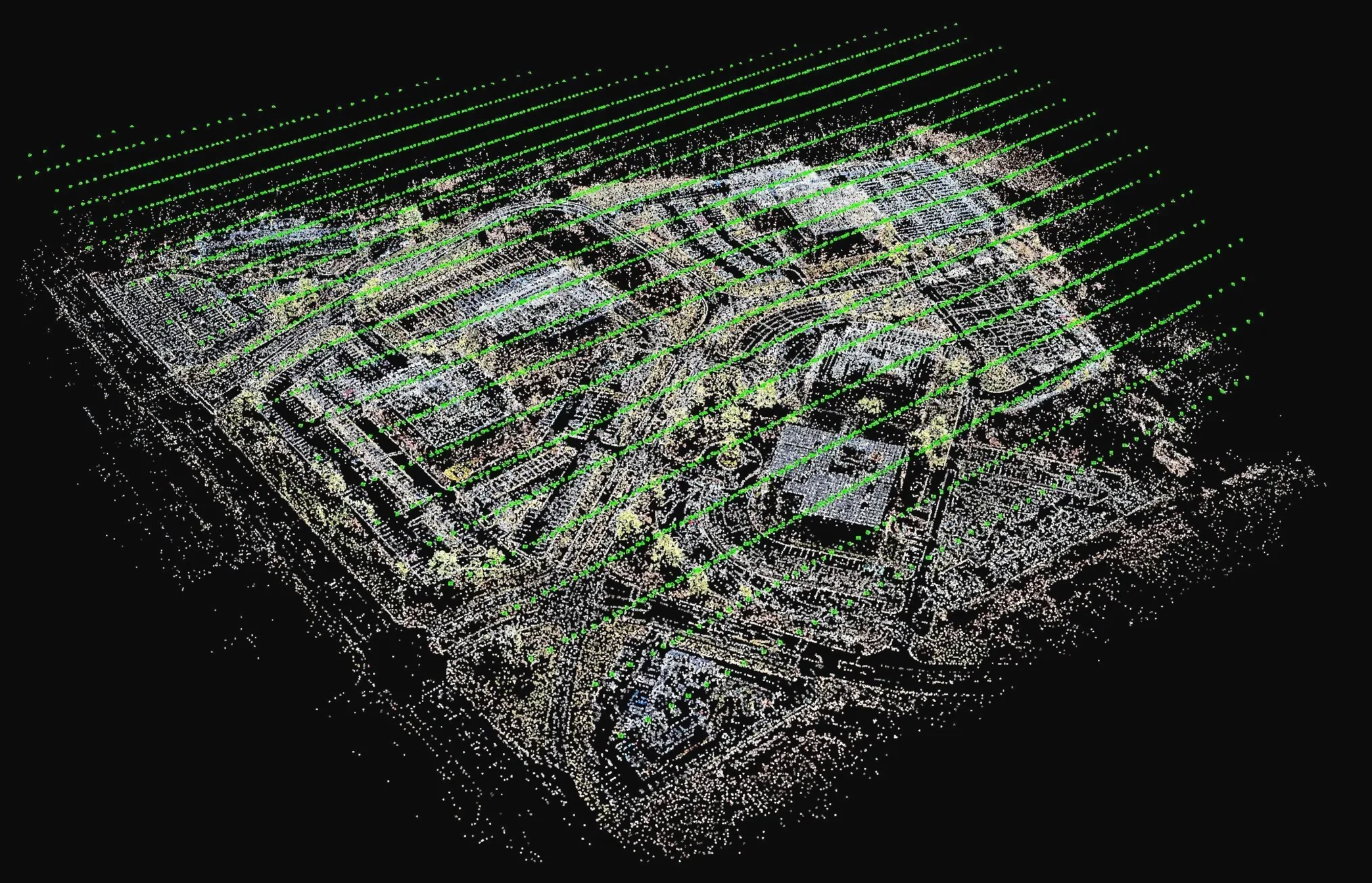
Accurate 3D models for complex sites, structures, and terrain.
We create detailed, measurable 3D models that let you review, measure, and analyze a site without being there in person. This can reduce site visits, lower risk, and make it easier to coordinate work and decisions.
Best for:
As-builts • Volume calculations • Façade & structure inspection • Engineering workflows -
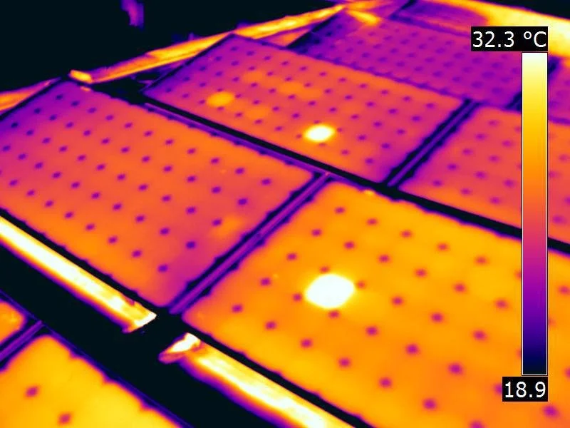
Infrared inspections that reveal issues you can’t see with standard cameras.
Thermal drone surveys help identify heat loss, electrical issues, moisture intrusion, and underperforming solar assets, quickly and safely, without disrupting operations.
Best for:
Solar inspections • Roof & building envelopes • Energy diagnostics • Search & recovery -
Clear, professional aerial visuals that show context, scale, and progress.
We capture aerial photos and video to support documentation, communication, and marketing, often alongside mapping or inspection work to make the most of a single flight.
Best for:
Real estate & land listings • Construction updates • Marketing & promotion
Select a service below to see typical use cases
Our Process
A clear, repeatable process focused on collecting accurate data and delivering reliable results.
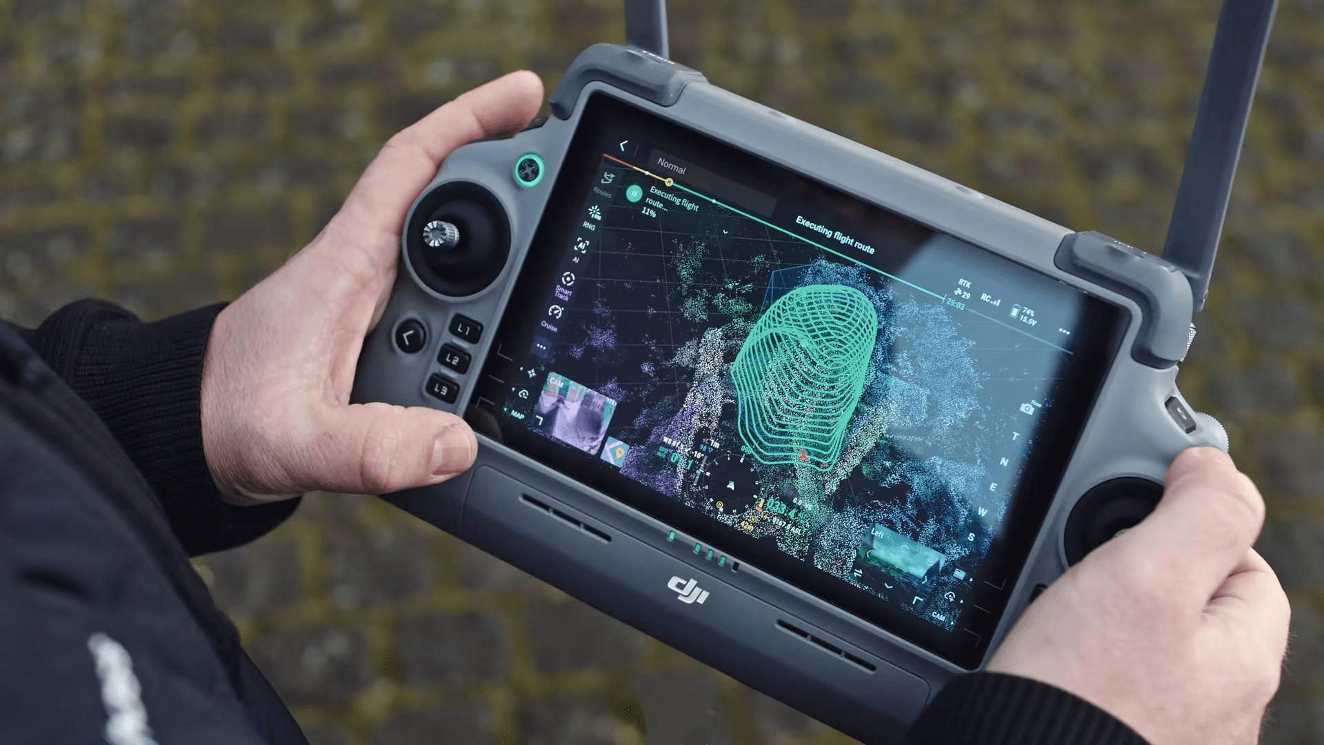
Flight Planning
Before any flight, we define objectives, review airspace, and secure required authorizations.
Includes airspace review, LAANC or FAA authorization when required.
On-Site Capture
We carry out the flight using purpose-built drones and planned flight paths, capturing consistent, high-quality data efficiently and safely.
RTK positioning, repeatable flight paths, and safety-first flight operations.
Processing
We process the raw data into clear, usable outputs so you can measure, review, and reference the site with confidence.
Orthomosaics, 3D models, thermal maps, and structured datasets.
Delivery
You receive clear, finished deliverables tailored to your project, delivered in standard formats ready for immediate use.
Formats compatible with CAD, GIS, reporting, and planning tools.
Request a Quote or Project Review
Share a few details about your site and objectives.
We’ll review your request and follow up with next steps or a tailored quote.